

Grounded. Groundbreaking.
Where Foresight Meets Follow Through
TRC is a leading, global consulting, engineering and construction management firm that provides environmentally focused and digitally powered solutions across our key markets.

Advising Clients on ESG Strategy and Reporting
TRC advised a U.S.-based energy infrastructure company on ESG frameworks and standards.
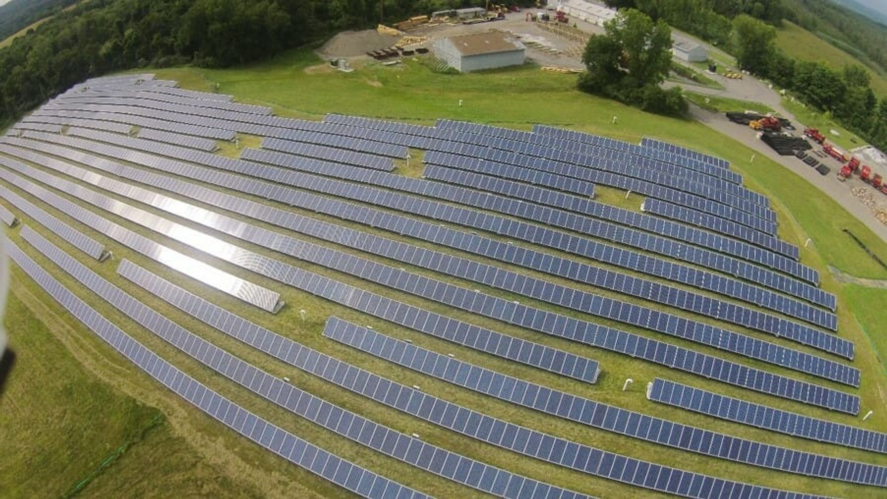
Patterson Municipal Landfill Redevelopment
This solar installation was the first to be constructed on a municipal solid waste landfill in the State of New York.

Platinum Equity Investment in Farnese Vini
EHS and ESG advice to identify risks and opportunities associated with the proposed acquisition.

$7B Reshore Acquisition by Private Equity Firm
TRC provided Transaction Advisory Services in an acquisition of a $7B global company.

Cabrillo Power Plant Decommissioning
TRC selected as Owner’s Engineer and later as the prime contractor for decommissioning five facilities..

Award for PennDOT Construction Inspection
TRC inspected and documented all work performed and confirmed compliance with all project specs.

Real Time Construction Inspection Insights
Connected Smart Sites - Real-time inspection insights shorten steel and concrete construction timelines.

Automated Title Services Speed Land Acquisition
Connected Field Forward - Fixed pricing and analytics help companies speed land acquisition.

Temecula Valley Regional Water Reclamation
TRC provided construction management services for $75 million expansion project that will increase treatment process by an additional 5 million gallons per day


Resources
Infrastructure Solutions
Covering all the bases from project feasibility studies and consultation to engineering and design to construction.

CORE
Technical Resources
Insights About Common Industry Challenges and Solutions

RENEWABLES
Renewable Energy Development
Integrated environmental, engineering and construction solutions for optimal project efficiency and accountability.

A focus forward.
As the world continues to advance, you need a partner that's advancing ahead of it. Day after day, project after project, TRC helps our clients design, power, connect and fuel the world forward.
Looking for effective solutions to your problems?
Turn to the experts at TRC.